StevenAndrewMartin.com/Cambodia/
Cambodia is a small country with an awe-inspiring history, where natural resources and the opportunities presented by geography played a leading role in the development of one of the world’s greatest historical civilizations, the Khmer.
Water, Stone, Iron and Wood
The natural abundance of fresh water has always been the basis of agriculture and transport systems, thanks to the Mekong River (Mother of Waters) and the Tonle Sap (Great Lake), two of the world’s greatest hydrologic systems. Meanwhile, ready access to stone, mainly rusty-red laterites and pastel sandstones, provided the building blocks of early civilization in the region. Emboldened with hardwood forests, iron ore deposits, and the mastery of fire, the Khmer were empowered to build houses, fire kilns, and smelt ores and forge the tools and weapons of the largest ancient empire in mainland Southeast Asia.
The Mekong River
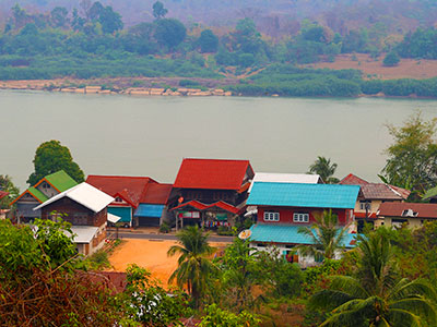
The Mekong is one of the longest rivers in the world, and is the symbolic heart of tropical mainland Southeast Asia. Seasonal flooding brings silt and nourishment to the land, and nutrients and freshwater fish to the Tonle Sap, producing two ecologically vibrant outcomes, the floodplain and the flooded forest. The floodplains receive water and minerals from as far away as Tibet, naturally irrigating and fertilizing enormous tracks of low-lying land, perfect for cultivation of rice and other food crops. As the Tonle Sap swells, it creates a flooded forest similar to the Amazon basin, where partially-submerged trees and their root systems create a haven for spawning fish. Historically, fish resources on the Tonle Sap were among the most plentiful on Earth. Elderly fishermen still boast of the days of their youth when the Tonle Sap was so teeming with fish that all they had to do was row their open boats into the lake and wait for a full catch to jump in.
The Tonle Sap
The Tonle Sap is a global hot-spot of biodiversity and a valued sanctuary for migrating birds. It is the largest freshwater lake in Asia, and the Tonle Sap River, the life-blood of the lake, is one of the few rivers in the world to display an astonishing natural feature: the biannual flow reversal. As rains brought by the Southwest Monsoon feed tributaries along the six countries of the Mekong (China, Myanmar, Thailand, Laos, Cambodia and Vietnam), the Tonle Sap River reverses the direction of its flow, and carries an extraordinary volume of water and fish species from the Mekong into the lake. This remarkable hydrologic event occurs from June to October, when the river fills the lake to as much as five times its normal depth and area. In the dry season (November to April), water drains out of the lake and toward the Mekong.
The lake is the key source of food for nearly fifty-percent of the Cambodian people and represents the greatest inland fishery network in Asia. The Mekong and the Tonle Sap remain the life-blood of a country and its resilient people who use their local culture and knowledge to follow the seasonal changes of the monsoon to survive.
Laterite and Sandstone
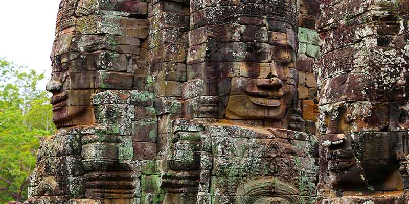
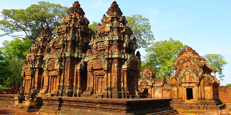
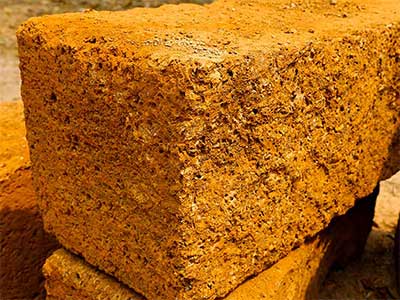
Laterite, a soil type and stone comprised of compressed soil, is a product of the tropical Cambodian basin, where thousands of years of alternating wet and dry seasons and oscillating floods create the conditions for its formation. As a process, silicates are washed out of the soil, leaving iron and aluminum oxides to build up and form laterite. Khmer architects learned many centuries ago how to cut cubes of this metallic mud-like rock from the ground in large blocks and set them to dry quickly, forming a near lava-like stone perfectly suited to building megalithic structures such as Angkor Wat. Laterite is to Cambodia what limestone was to the Egyptians. It is a workable stone employed as the base of nearly one thousand Khmer temples throughout the country. However, laterite forms coarse blocks pitted with holes. It is difficult to prepare a clean, smooth surface with the aesthetic qualities desired for a religious monument using laterite.
"Laterite is to Cambodia what limestone was to the Egyptians"
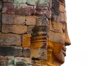
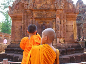
On the other hand, sandstone, another resource available to the Khmers, is an exceptional facing stone. Sandstone was also used as a base for carving fine artwork such as bas-reliefs, many of which are still visible today in temples and monuments throughout Cambodia.
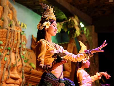
Another geographic blessing to the Khmer economy and collective conscious is Phnom Kulen, a forty kilometer long isolated chain of small sandstone mountain plateaus fifty kilometers to the northeast of Siem Reap. The Kulen Mountains are sacred to the Khmer and were the definitive source of sandstone throughout the Angkorian period (early 9th to 15th century). It is a clean and sometimes colorfully pink soft stone, ideal for depicting the Apsara dancers (Khmer celestial nymphs) and many other Hindu and Buddha images still visible today. The Kulen Mountains were a definitive stronghold against invading forces from Java during the early Khmer period, later forming a vital part of the Khmer empire’s political and cultural geography, and are still regarded by Cambodians today as the source of holy waters.
Iron and Fire
The early Cambodians developed a mastery of fire and built kilns to smelt ores, cast iron, and fire ceramics for pots and bowls used in households and temples for storing foods, water, and oils. Iron ore was an important natural resource in Khmer history, and ore deposits began to be exploited during the pre-Angkor period. The Khmer demonstrated an early understanding of technologies needed for casting iron, particularly for tools and weapons. The need for iron ores and production drove development and distribution networks, including roads throughout the basin. Iron gave the Khmer purpose, unity, and regional superiority.
In this Day and Age
Angkor, formerly a city of nearly a million people, is the result of a complex interaction of cultural and industrial influences, whose natural resources provided the setting for a globally unique historical geography which gave birth to a civilization that, at its zenith, was arguably the greatest in the pre-industrialized world.
Today, there is a renaissance of Khmer architectural and engineering spirit, unmistakably visible in the construction of new buildings and hotels in Siem Reap, Phnom Penh, and around the country. After the horrors of the Pol Pot period, Cambodia has recovered as swiftly as jungle growing back over a ruined temple, and now the country is back on track as a vibrant economy which is one of the major engines of development at the heart of the ASEAN region. Perhaps more than ever, the sustainability of Cambodia’s unique natural resources and the natural gifts of her geography will once again play leading roles as a new Khmer civilization once more steps forward to take its rightful place among the world’s oldest and proudest human cultures ♦
This research was inspired through associates and experiences at the 2014 Indo-Pacific Prehistory Association (IPPA) in Siem Reap, Cambodia.
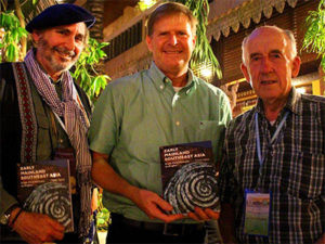
PHOTO
- Prof. David Blundell (left)
- Dr. Steven Martin (center)
- Prof. Charles Higham (right)
Special thanks to Peng Ponna (William) at Paññāsāstra University and our guide, Ratha Seng in Siem Reap, Cambodia.
Revised article available at StevenAndrewMartin.com/Cambodia
Faculty of International Studies, Prince of Songkla University, Phuket, Thailand.
Study Abroad Journal Film - Short Recordings Made During Field Research
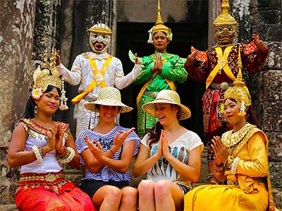
Aspara Dance, Siem Reap, Cambodia
Beng Mealea Temple, Siem Reap, Cambodia
1000 Lingas, Phnom Kulen, Siem Reap, Cambodia

